- Category: Uncategorised
- Written by Super User
- Hits: 3939
Wehrle Planing
The Wehrle-Charette - Development plans up to 2025
The Factory and the College inside the Wehrle-Werk
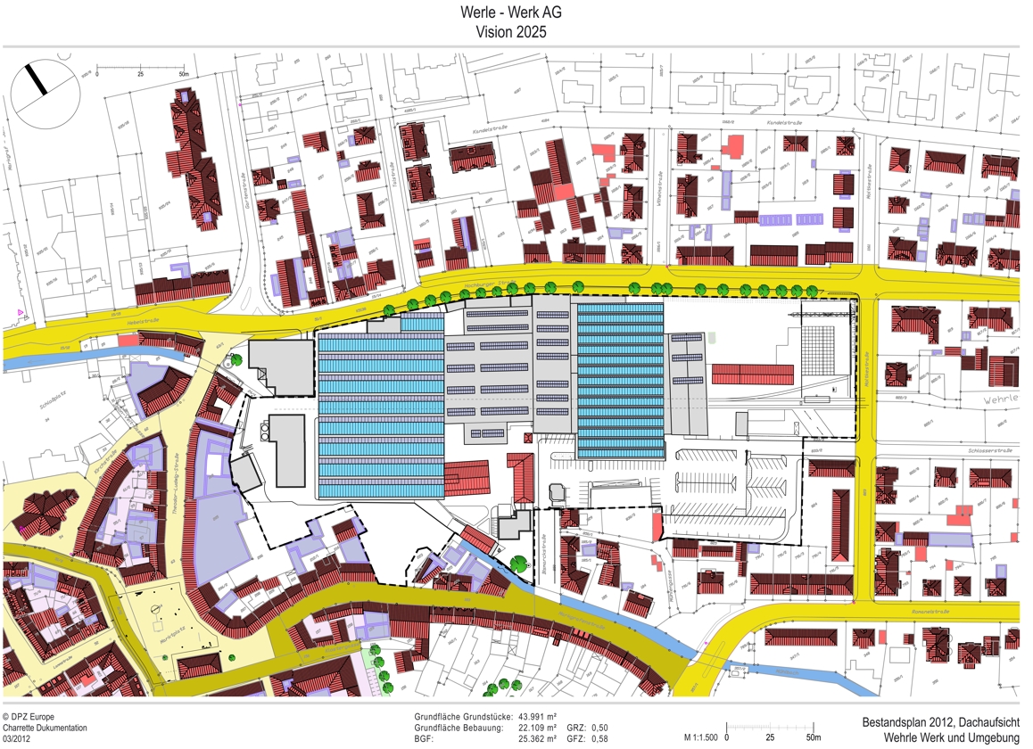
| Looking at the present stock of the Wehrle plant from the roof view gives a good overview. Of particular interest here is first of all Hall 2, visible here through the light blue roof on the left side of the plant site. According to the results of the charrette Emmendingen insebsondere the areas west of hall 2 and the western third of hall 2 could be used for the university. In addition, the southern quarter of the hall should be able to be included as an area. To the left of Hall 2, the old boiler house can be seen, which is to be demolished and would thus provide an open area, a space for the university. The old factory canteen on the left edge of this square could also be used by the university as a meeting and dining hall. |
|||
| As-built plan 2012 | |||
 |
|||
|
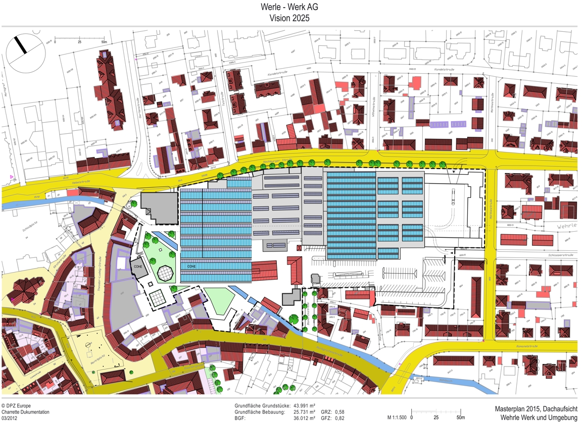
Of great importance for a redesign of the plant site are the existing open spaces on the right side of the plan towards Moltkestraße.
|
|||
| Masterplan 2015 | |||
 |
|||
|
The measures on the right (eastern) side are to be seen as the most important urban development change. Until now, residents had an unrestricted view of the open warehouse, the crane operation and the loading and unloading processes with corresponding noise. This situation will be improved in terms of urban development by the structural closure of the plant site. |
|||
|
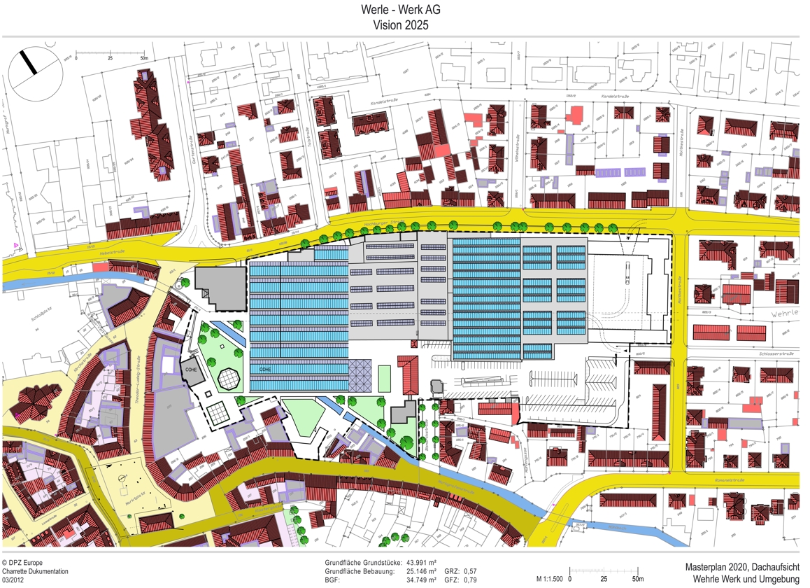
Masterplan 2020 |
|||
 |
|||
|
|
|||
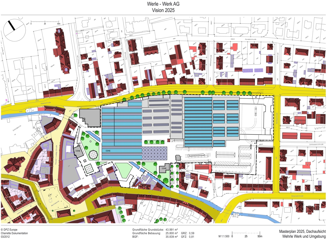
| Masterplan 2025 | |||
 |
|||
|
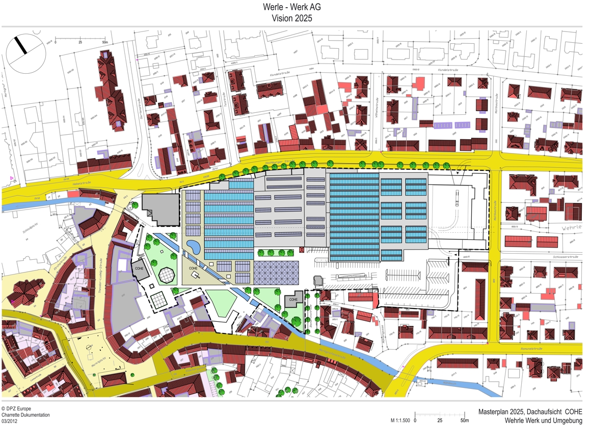
5 years later, the site has developed significantly. The Master Plan 2025 shows the development of the site between Hall 5 and Markgrafenstrasse. Here, the last two old buildings are being demolished (on the left behind the Bismarkstr. entrance) to make room for a new expansion of the university. A new building along Bismarckstrasse will serve as additional living space for the university's students. |
|||
| Masterplan 2025 - Roof top with opening of the Mühlbach-brook in the university part |
|||
 |
|||
|
The areas of the planned European College of Human Ecology are kept in sand tone. The newly developed areas and the new access roads to the Wehrle plant are shown in light gray.
|
|||
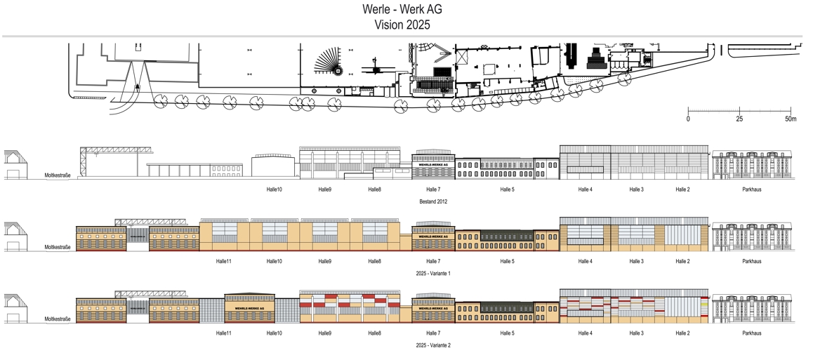
| Facade of the Wehrle-Werks in the Hochburger Straße | |||
 |
|||
|
The top two rows show the location and views of all existing buildings along Hochburger Strasse. At present, as the second row from the top shows, the facades of the existing buildings appear very massive, unattractive, and unrelated to the human scale. Individual facades could certainly be attractive. However, in the context of the dominant halls and the parking garage, the effect is lost. Each building stands alone and the halls do not form a cohesive ensemble. The two bands below show design options that could be used here, depending on price and feasibility, to achieve a more attractive streetscape. The individual facade elements of each building need to be emphasized in the context of its neighbors. In this way, the massive overall structure of the plant's facade would be broken down into highlighted elements that would dignify the individual buildings and thus harmonize the overall effect. |
|||
